2024-25 Winter League Championships – Point Defiance Park
WINTER LEAGUE
Saturday, February 22 at Point Defiance Park in Tacoma, WA
Meet Director: Michelle Kastner
- Pre-registration is required for ALL Winter League Events. There is NO day-of-event registration.
- Public Reg will close 2/19/25 at 11:59 pm for this meet.
- PUBLIC start time sign-ups are open from February 8th at 3 pm to Feb 19th at 11:59 pm.
- ALL runners will be called to enter the start procedure line 8 minutes prior to their assigned/picked start time. Please be race-ready when your name is called.
- 2024-25 Start Procedures can be found here.
- Read the 2024-25 WIOL Rules here and the 2024-25 Public Rules here.
- Site map to the RACES is here.
- Site map to the AWARDS/COMMUNITY GATHERING is here.
- Start list is here.
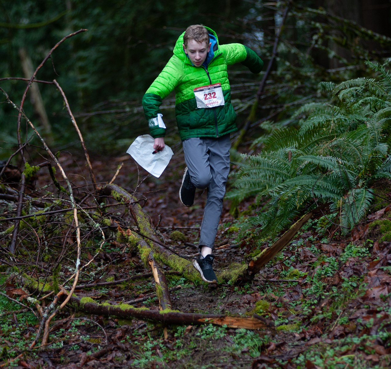
Winter League is the Pacific Northwest’s premier competitive orienteering series for all ages.
- Elementary, Middle School, High School and College students compete under the banner of the Washington Interscholastic Orienteering League (WIOL).
- Winter League public courses offer a range of categories from a competitive long advanced category to non-competitive beginner-friendly categories at every event!
COURSES
Course designer(s): Chris Cooper & Ing Uhlin
WIOL Courses
| Controls | Length | |
| Elementary | 12 | 1.5 km |
| Middle School | 13 | 2.4 km |
| Rookie-Female | 12 | 2.5 km |
| Rookie-Male | 12 | 2.6 km |
| JV Female / JV College | 15 | 2.9 km |
| JV Male | 13 | 3.0 km |
| Varsity | 16 | 4.2 km |
| College Varsity | 19 | 5.3 km |
Public Courses |
| Controls | Length | |
| Beginner | 12 | 1.5 km |
| Advanced Beginner | 12 | 2.5 km |
| Intermediate | 15 | 2.9 km |
| Short Advanced | 16 | 4.4 km |
| Long Advanced | 19 | 5.3 km |
How are courses measured?
Courses are measured as the crow flies, in a direct line from control to control. Unless you have wings, you will travel farther than this distance! Courses are measured in kilometers, so a good rule of thumb is to simply round up to miles to estimate how far you will go. So in a 5 kilometer race, you’ll likely travel up to 5 miles.
COURSE NOTES
From Ing and Chris
General Information:
- From the upper end of Owens Beach parking lot, access to the “Start” is a 450 m walk along Five Mile Rd. Plan on a 10-minute walk to Start from the parking lot. There is no parking at “Start”. From the bottom of Owens Beach parking lot (where there also are restrooms), you can follow the old access road (now a pedestrian path) from the beach up to the Start.
- There will be a coat drop for this event. However, the coat pickup will be at the mandatory crossing (south end of the parking lot) and not at Download. Look for the “Coat Pickup” sign.
- The gorge east of the Rhododendron Garden has been marked out of bounds, as well as a roadway underpass near the Japanese Garden. These areas have been marked out of bounds for your safety and to avoid the park’s vegetation restoration work. Do not enter these areas.
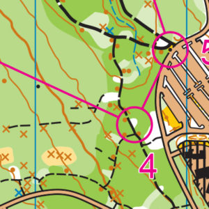
- The Point Defiance map has a special symbol for distinct trees that have fallen. This symbol is used in two cases; either for logs suspended above a reentrant or for old growth logs with a diameter of at least 1.5 m that cross or divert a trail. The symbol for these fallen logs is a brown line roughly 10 mm in length showing the logs’ alignment in the field.
- Point Defiance Park is strewn with hundreds of fallen trees. As a result, the near infinite number of rootstock symbols makes the map practically illegible. To increase map legibility, all rootstocks have been removed from the map. Even with the removal of rootstocks from the map, there is an overabundance of point features along the park trails. Often, tight groupings of point features have been mapped as one single feature. When multiple features occur within a control circle, column “C” on the description sheet will tell you on which of the features that the control is located.
- With so many trailside point features, be on the watch for parallel errors due to mistaken attack points.
- Vegetation can change rapidly from open forest to dense vegetation and back again. These changes can occur in smaller areas than a 1:10,000 map will be able to reflect. Vegetative areas have been updated to best reflect the overall runnability of an area.
- There are countless deer and social trails running throughout the park. As mentioned above, it is impossible to include and map the spider web of trails that run through portions of the open forest. In these areas, we recommend using a compass to ensure you are moving in the correct direction.
- To protect the park’s vegetation, all controls have been set on the park’s main trails, on smaller side trails or on the bare forest floor. Whenever possible, please use the trails or vegetation free areas to access the controls. Avoid trampling vegetation whenever possible.
The Courses:
- The base map scale for the Point Defiance map is 1:10,000. However, the event map scale is 1:7,500 for the Beginner/Elementary and Middle School courses and 1:10,000 for all other courses.
- All courses except Short Advanced and Long Advanced / Collegiate Varsity have a mandatory crossing point on the west side of Five Mile Drive. Controls have been set to either side of the crossing to channel runners to the designated crossing point. To ensure runner safety, please use the staffed crossing point and heed the crossing guards.
- In addition to the mandatory crossing mentioned above, classes JV, Varsity, Collegiate, Short and Long Advanced may cross the Five Mile Drive to the south and east. Due to the myriad number of available route choices, there are no designated crossing points outside of the mandatory crossing point mentioned above. Please take care when crossing all park roadways.
- The mandatory crossing point at the south end of the Owens Beach parking lot is the perfect location to cheer on your team or get a great action photo. However, please ensure you do not block any of the trails leading to and away from the crossing point.
- Route choices through the zoo’s animal enclosures are generally discouraged (lions were fed on Thursday so…).
- Due to the large map scale and resulting general vegetation and trail mapping, consider trading additional distance to achieve a solid attack point versus a more direct approach along less defined trails. Know before you go!!
- Remember, you always have a handrail if you use a compass, and a backstop if you pace count!
- Have fun and enjoy the beauty of this unique metropolitan park!
SCHEDULE
This event is Pre-Registration Only.
Schedule:
9 am – Info Tent and Newcomer Instruction Opens
9:38 am – Start process begins
9:46 am – First start
12:30 pm – Last Start
2 pm – Awards Show Starts
Why is there a start window?
This event uses an interval start, which means that participants are started in waves instead of all at once. When you arrive at the start tent, find the chute for your course and follow the start volunteer’s instructions.
PRICES
PRE-REGISTRATION PRICES
$22 base price
– subtract $5 for CascadeOC members
– subtract $5 for using your own e-punch
Participating as a group? Just $5 for each additional adult (16+) group
member, no cost for additional minors. Max group size is 4 participants.
What’s an e-punch?
An e-punch records your race. At each control, you’ll dip the e-punch into an electronic box, which will beep and flash as confirmation. After you finish, you’ll download the e-punch at the download tent and get a receipt that show which controls you visited and how long you took between each; these are your “splits.”
Part of the fun of orienteering is comparing your splits with people who completed the same course, and discussing the routes you took!
SIGN UP
There is no Day-of-Event registration. Pre-registration will close Wednesday 2/19/2025 at 11:59:00 PM.
Remember to also sign up for a start time for public runners. Start time sign-ups for WL Champs will be open from February 8th at 3 pm to Feb 19th at 11:59 pm.
LOCATION
PARKING
Is free and is located at the parking lot at Owen Beach. See site map here. Please only park in this lot, which is where our permit is for.
CARPOOL
Looking for a carpool? Join the club email group and share your request to find a ride.
SAFETY & ETIQUETTE
Return to the Finish
All participants MUST return to the finish and download their e-punch or turn in their punch card.
Even if you have not finished your course, you must still return to the the finish and confirm with event staff that you have returned safely.
Out of Bounds
Some areas may be marked out of bounds. It is imperative to respect these boundaries to maintain our relationships with land managers. Participants MUST NOT go out of bounds. Any participant caught going out of bounds will be disqualified.
Course Closure
All participants MUST return to the finish by course closure time. If a participant does not return by course closure, event volunteers will begin coordinating a search party.
If you need a long time on the course, start as early in the start window as possible, wear a watch, and be prepared to cut your course short to make it back by the course closure time.
Whistle
All participants MUST carry a whistle on the course. Complimentary whistles are available at the start tent (please only take one).
If you are injured on the course and need assistance, blow three long blasts to call for help.
If you hear a call for help, abandon your course to find the person in distress.
Voices
Part of the fun and fairness of orienteering is navigating your own course, so please be polite when you find a checkpoint and don’t holler that you’ve found it.


