2025-26 Winter League #4 – University of Washington
WINTER LEAGUE
Saturday, December 20 at University of Washington in Seattle, WA
Meet Director: Michelle Kastner
- Please note that the parking and the staging area for this event are in new locations, not the usual ones.
- Pre-registration is required for ALL Winter League Events. There is NO day-of-event registration.
- Public Reg will close 12/17/25 at 11:59 pm for this meet.
- PUBLIC start time sign-ups are now part of the Public registration site (see under your Current Registrations). Sign-ups are open from December 6th at 3 pm to December 17th at 11:59 pm.
- ALL runners will be called to enter the start procedure line 8 minutes prior to their assigned/picked start time. Please be race-ready when your name is called.
- 2025-26 Start Procedures are here.
- 2025-26 WIOL Rules are here and the 2025-26 Public Rules are here.
- Site map is here.
- Start list is here.
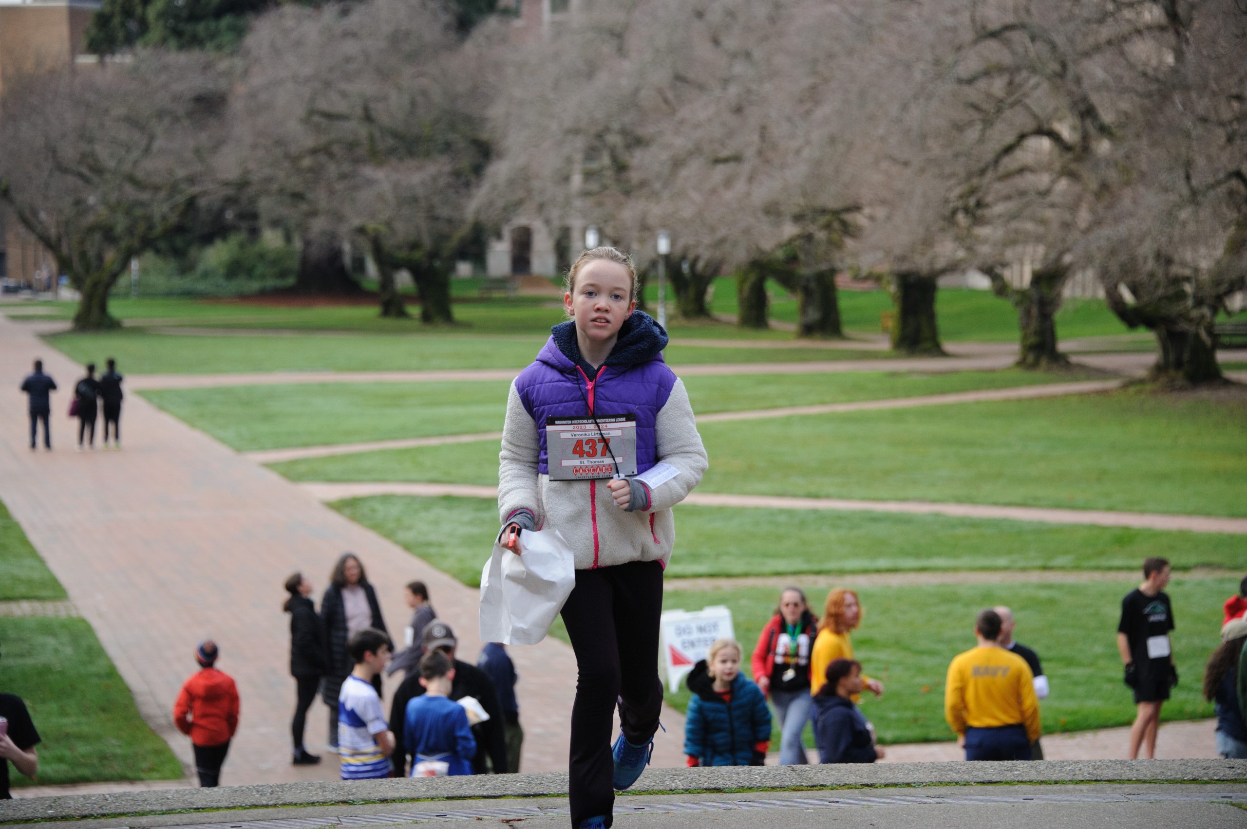
Winter League is the Pacific Northwest’s premier competitive orienteering series for all ages.
- Elementary, Middle School, High School and College students compete under the banner of the Washington Interscholastic Orienteering League (WIOL).
- Winter League public courses offer a range of categories from a competitive long advanced category to non-competitive beginner-friendly categories at every event!
COURSES
Course designer(s): Peter Golde
Public Courses
| Controls | Length | Climb | |
| Beginner | 11 | 1.4 km | 20 m |
| Advanced Beginner | 12 | 2.5 km | 30 m |
| Intermediate | 14 | 3.2 km | 50 m |
| Short Advanced | 16 | 4.1 km | 75 m |
| Long Advanced | 20 | 5.5 km | 95 m |
WIOL Courses
| Controls | Length | Climb | |
| Elementary | 11 | 1.4 km | 20 m |
| Middle School | 12 | 2.4 km | 30 m |
| Rookie-Female | 12 | 2.5 km | 30 m |
| Rookie-Male | 13 | 2.5 km | 30 m |
| JV Female / Collegiate JV | 14 | 3.2 km | 50 m |
| JV Male | 14 | 3.2 km | 50 m |
| Varsity | 17 | 4.1 km | 60 m |
| Collegiate Varsity | 20 | 5.5 km | 95 m |
How are courses measured?
Courses are measured as the crow flies, in a direct line from control to control. Unless you have wings, you will travel farther than this distance! Courses are measured in kilometers, so a good rule of thumb is to simply round up to miles to estimate how far you will go. So in a 5 kilometer race, you’ll likely travel up to 5 miles.
COURSE NOTES
Scale: 1:4,000. Contours: 2.5 meters. Mapping standard: Sprint (ISSprOM)
Welcome back to the University of Washington! Cascade Orienteering Club has been using this map for 40 years now – since long before “Sprint Orienteering” was even a gleam in the eye of the IOF. The complex map makes for an always fast and exciting race venue, and the continual replacement of buildings make things a little different each time even for long time veterans.
All of the race will be in an urban, campus setting, running mostly on pavement and navigating in and around buildings. It will all be very similar to the campus part of Shoreline College, with nothing like the forest part. Although there is a slope to the campus, the climb is quite gradual in most places. The numerous paths, walkways, and buildings keep things fast and tricky; it’s easy to get turned around by 90 degrees or more, so keeping an eye on your compass will help you not run astray in the wrong direction. Check your control descriptions carefully, as your course designer sometimes likes to tuck controls in hidden locations.
Key things to keep in mind:
· Most of the paved areas and paths are open to cars, bicycles, and scooters. Always keep situational awareness and look before making sudden changes in direction.
· There is one major loop road around campus (Stevens Way) that all courses will cross, often multiple times. The traffic is relatively slow and there are many crosswalks and some stop signs, so crossing shouldn’t be difficult, but always look both ways and be careful!
· UW is renowned for its beautiful campus including its lovely landscaping. Landscaped areas are mapped in olive green and are strictly prohibited to enter, even a single step. Although some of the areas are small on your map, it should be obvious: don’t enter anywhere where you might damage any planting or vegetation (it is OK to run across open grass). In one place I put orange tape to make it very clear not to enter. The olive areas are used as control descriptions in a few places (symbol: a flower inside a square); in those cases it will always be possible to punch the control without entering the landscaped area. If landscaping gets damaged, we will not be allowed back and will lose access to this area forever.
· UW is blessed with many large pieces of public art, which I have used liberally for control placement. These are mapped with a black circle with a dot inside. The rarely used “statue/monument” control description symbol is used (it kind of looks like a tent.)
· Construction areas are marked with purple hatching on your map.
Course 9 (Long Advanced / College Varsity) only:
· There is a map flip and your map is printed on both sides. Once you get to control 10, flip over the map and continue racing. Make sure you begin on the side marked “Part 1”.
SCHEDULE
This event is Pre-Registration Only.
9:00 am – Info tent and newcomer instruction opens
9:34 am – Start process begins
9:42 am – First start
11:00 – Training Tent Opens
12:30 pm – Last start
1:30 pm – Post Meet Sprint Training begins
2:30 pm – Course closure
Why is there a start window?
This event uses an interval start, which means that participants are started in waves instead of all at once. When you arrive at the start tent, find the chute for your course and follow the start volunteer’s instructions.
PRICES
PRE-REGISTRATION PRICES
$22 base price
– subtract $5 for CascadeOC members
– subtract $5 for using your own e-punch
Participating as a group? Just $5 for each additional adult (18+) group
member, no cost for additional minors. Max group size is 4 participants.
What’s an e-punch?
An e-punch records your race. At each control, you’ll dip the e-punch into an electronic box, which will beep and flash as confirmation. After you finish, you’ll download the e-punch at the download tent and get a receipt that show which controls you visited and how long you took between each; these are your “splits.”
Part of the fun of orienteering is comparing your splits with people who completed the same course, and discussing the routes you took!
SIGN UP
There is no Day-of-Event registration. Pre-registration will close Wednesday 12/17/2025 at 11:59:00 PM.
Remember to also sign up for a start time for public runners. Start time sign-ups for WL #4 will be open from December 6th at 3 pm to Dec 17th at 11:59 pm.
LOCATION
PARKING
-
We have been assigned to park in E-18 for our event. It is a flat rate of $8.15 for the day to park there.
-
You need to download the Pay by Phone app (link here) to park at UW.
-
There is a parking lot, E-97, where you can drop off runners and equipment. It borders the Hec Ed Bridge on one side, so it is the closest allowed drop off location.
-
YOU MAY NOT drive into campus to drop off runners/equipment.
-
Should you be tempted to grab a parking spot in E97 or in nearby E17, E19, or E20, those lots charge $5/hour and are NOT the lots we were asked to use for our event. They are however not in the OOB zone for competitors.
CARPOOL
Looking for a carpool? Join the club email group and share your request to find a ride.
OTHER METHODS
PUBLIC TRANSIT
Take the Link 1-Line to University of Washington Station, a slightly shorter walk to the event center than parking at E-18!
Many buses from around the region also serve the Montlake Triangle.
Please respect the competition area by crossing East to the stadium, then heading North to the Hec-Ed bridge to access the event center. Some routes (the 45, 67, 75, and 372) travel through campus on E Stevens Way, which is part of the competition area. Do not get off inside the competition area.
Routes serving the Montlake Triangle include:
255 every 15 minutes from Kirkland, S Kirkland P&R, Juanita, Totem Lake
542 every 30 minutes express from Redmond
271 every 30 minutes from Bellevue, Eastgate, and Issaquah
43 from First Hill and Capitol Hill
44 from Ballard, Wallingford
48 from Central District and Mount Baker
THE MAP
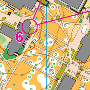
University of Washington has a LOT of buildings–some arranged north/south, some at a 45-degree angle, some at no particular angle, and most along two curving roads, criss-crossed with acres of angled paths, sidewalks, and individually-mapped trees. Now run it, while keeping all the angles, buildings and roads straight in your route planning!
Read more on the map pageSAFETY & ETIQUETTE
Return to the Finish
All participants MUST return to the finish and download their e-punch or turn in their punch card.
Even if you have not finished your course, you must still return to the the finish and confirm with event staff that you have returned safely.
Out of Bounds
Some areas may be marked out of bounds. It is imperative to respect these boundaries to maintain our relationships with land managers. Participants MUST NOT go out of bounds. Any participant caught going out of bounds will be disqualified.
Course Closure
All participants MUST return to the finish by course closure time. If a participant does not return by course closure, event volunteers will begin coordinating a search party.
If you need a long time on the course, start as early in the start window as possible, wear a watch, and be prepared to cut your course short to make it back by the course closure time.
Whistle
All participants MUST carry a whistle on the course. Complimentary whistles are available at the start tent (please only take one).
If you are injured on the course and need assistance, blow three long blasts to call for help.
If you hear a call for help, abandon your course to find the person in distress.
Voices
Part of the fun and fairness of orienteering is navigating your own course, so please be polite when you find a checkpoint and don’t holler that you’ve found it.


