2024-25 Winter League Celebration Weekend Relay – Saint Edward State Park
WINTER LEAGUE
Sunday, February 23 at St. Edward State Park in Kenmore, WA
Meet Director: Michelle Kastner
- You need a Discover Pass to park at this venue. There is a pay station (maybe by the parking lot east of the lodge).
- Pre-registration only for this event. There is NO day-of-event registration.
- Registration closes on 2/20/25 at Noon for this meet.
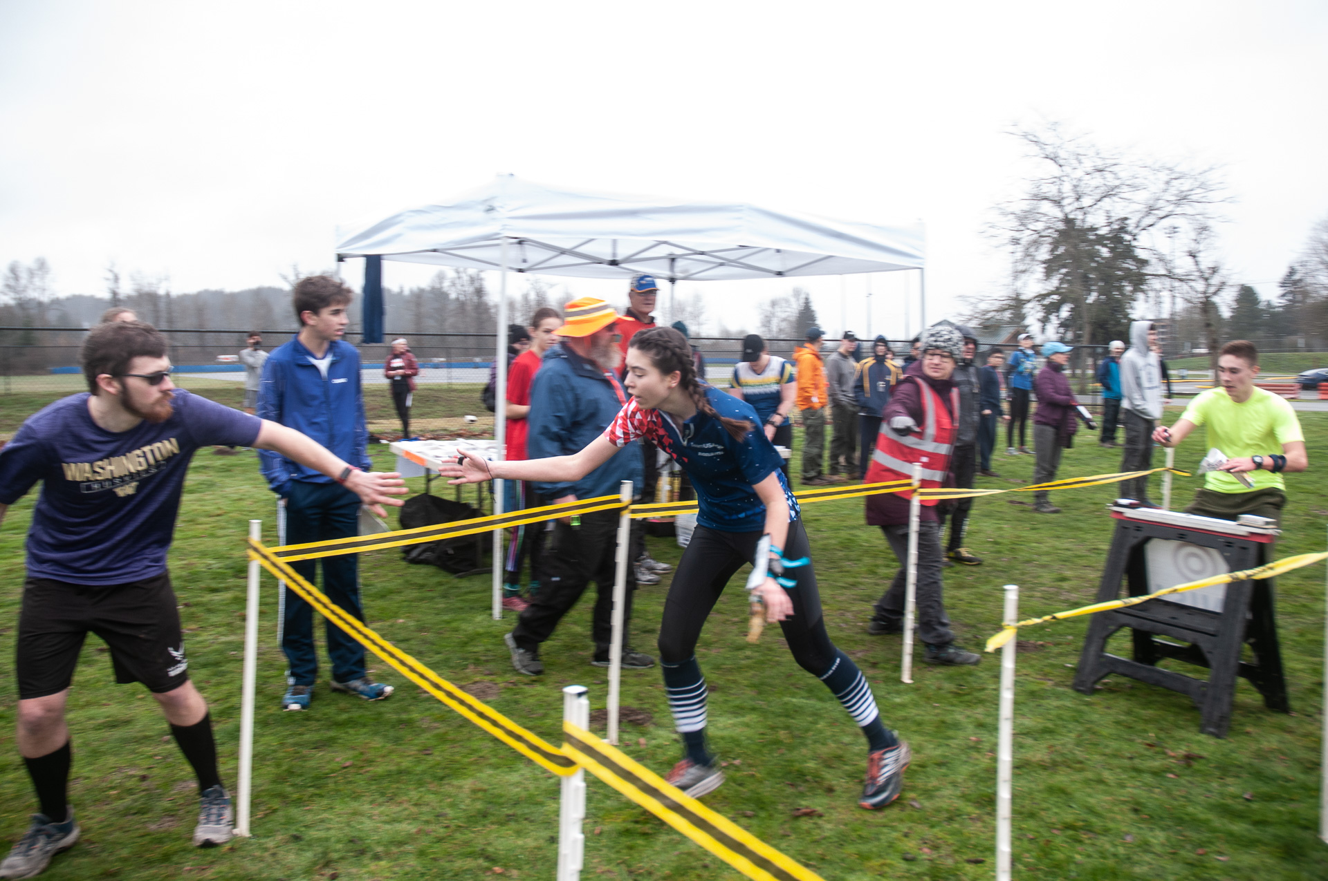
- Mass start at 11 am for first leg.
- Site map is here.
To celebrate the end of another successful Winter League season, we are hosting a low-cost 3-person WL Relay on Sunday, February 23rd. We hope you join us for the fun and excitement!
How it will work:
- Gather your team of three and decide your team name and who is running which leg.
- Legs 1 and 3 will be equal in distance and difficulty. If you choose Leg 1, you will be part of the mass start at 11 am.
- Leg 2 will be easier than legs 1 & 3. Leg 2 will be equivalent to JV Rookie/Advanced Beginner.
- If you want to participate but do not have a team you can do that too!
- Everyone registers in the Public Registration system here. When you register:
-
- ONLY if ALL three team members were WIOL runners this season, choose WIOL Relay (Leg 1, 2, or 3).
- All others choose OPEN Relay (Leg 1, 2, or 3).
- There are no other restrictions when forming a team.
- Be sure to tell us your team name and list of teammates when you register.
- If you want to participate but do not have a team, just choose the seventh-course option “I don’t have a team, please pair me up” and we will do that for you.
COURSES
Course designer(s): Rebecca Jensen
| Controls | Distance | Climb | |
|
Leg 1 (Advanced) |
18 | 3.3 km | 80 m |
| Leg 2 (Intermediate) | 16 | 2.2 km | 30 m |
| Leg 3 (Advanced) | 14 | 3.1 km | 65 m |
How are courses measured?
Courses are measured as the crow flies, in a direct line from control to control. Unless you have wings, you will travel farther than this distance! Courses are measured in kilometers, so a good rule of thumb is to simply round up to miles to estimate how far you will go. So in a 5 kilometer race, you’ll likely travel up to 5 miles.
COURSE NOTES
SCHEDULE
9:30 am Team check-in opens
10:00 am Beginner instruction opens
10:30 am Team check-in closes
10:40 am Beginner instruction ends
10:45 am Pre-start briefing; demonstration of exchange procedures
11:00 am Mass start
11:45 am Leg 2 mass start if your teammate is not back to tag you
12:30 pm Leg 3 mass start if your teammate is not back to tag you
1:45 pm Course Closure
This event will be a mass start at 11 am.
PRICES
PRE-REGISTRATION PRICES
$3 or 1.5 volunteer points = base price (Cascade OC members and non-members, with or without e-punch rental)
What’s an e-punch?
An e-punch records your race. At each control, you’ll dip the e-punch into an electronic box, which will beep and flash as confirmation. After you finish, you’ll download the e-punch at the download tent and get a receipt that show which controls you visited and how long you took between each; these are your “splits.”
Part of the fun of orienteering is comparing your splits with people who completed the same course, and discussing the routes you took!
SIGN UP
PRE-REGISTRATION PRICES
$3 or 1.5 volunteer points = base price (Cascade OC members and non-members, with or without e-punch rental)
LOCATION
PARKING
See site map here. You need a Discover Pass to park at this venue. There is a pay station.
CARPOOL
Looking for a carpool? Join the club email group and share your request to find a ride.
THE MAP
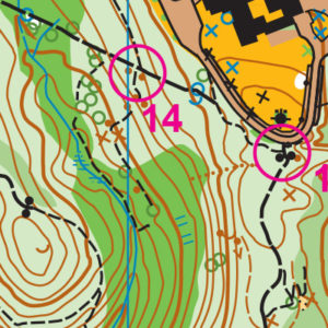
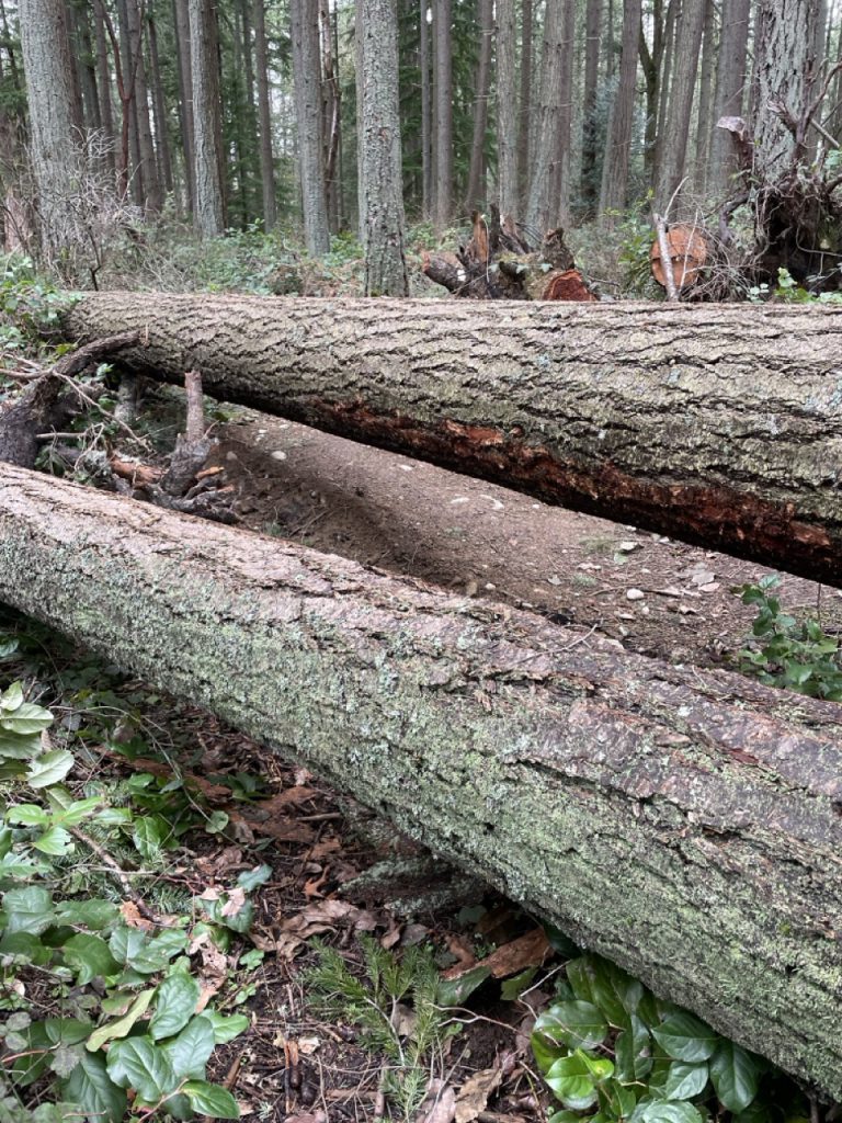
Many of our venues are built on hills. St Edward Park is the hilliest of them all! It is also among the first maps that this club created, more than 30 years ago.
This map combines two open and developed campuses with a complex trail network behind the college and another, simple set of trails going down the steep, steep slopes from the St. Edward historic seminary building to the water.
When used with adjacent land, this park provides enough geographic range that it has been used with a mountain bike orienteering course. Even without that section, it is routinely part of the large meets in the winter series and student league.
Read more on the map pageSAFETY & ETIQUETTE
Return to the Finish
All participants MUST return to the finish and download their e-punch or turn in their punch card.
Even if you have not finished your course, you must still return to the the finish and confirm with event staff that you have returned safely.
Out of Bounds
Some areas may be marked out of bounds. It is imperative to respect these boundaries to maintain our relationships with land managers. Participants MUST NOT go out of bounds. Any participant caught going out of bounds will be disqualified.
Course Closure
All participants MUST return to the finish by course closure time. If a participant does not return by course closure, event volunteers will begin coordinating a search party.
If you need a long time on the course, start as early in the start window as possible, wear a watch, and be prepared to cut your course short to make it back by the course closure time.
Whistle
All participants MUST carry a whistle on the course. Complimentary whistles are available at the start tent (please only take one).
If you are injured on the course and need assistance, blow three long blasts to call for help.
If you hear a call for help, abandon your course to find the person in distress.
Voices
Part of the fun and fairness of orienteering is navigating your own course, so please be polite when you find a checkpoint and don’t holler that you’ve found it.


