2021 Winter Virtual Series #1 – Shoreview Park
Saturday, January 9 thru Friday, January 22 at Shoreview Park/Shoreline CC in Shoreline, WA
Update: please use the updated course maps linked below, NOT the maps in UsynligO (unfortunately, it is not possible to update the maps in UsynligO without losing all finisher data). The courses are the same but the map has some updates.
We’re starting a new decade with a new (but hopefully short-lived) series: the Winter Virtual Series.
See the Winter Virtual Series page for more information and registration details.
Please NOTE: Even though these are not organized events, please follow the WA state guidelines and wear a mask whenever you are approaching or passing other people or are within 6 feet of others.
COURSES
Course designer(s): Dave Tallent
The courses are short so you can run more than one, run the same course multiple times, and/or try out different route choices.
Model (test) – 0.4k, 3 controls
White (Beginner) – 0.9k, 7 controls
Yellow (Advanced Beginner) – 1.6k, 7 controls
Orange (Intermediate) – 2.0k, 9 controls
Red (Advanced) – 2.8k, 11 controls
How are courses measured?
Courses are measured as the crow flies, in a direct line from control to control. Unless you have wings, you will travel farther than this distance! Courses are measured in kilometers, so a good rule of thumb is to simply round up to miles to estimate how far you will go. So in a 5 kilometer race, you’ll likely travel up to 5 miles.
SCHEDULE
- January 8, 6pm – Courses posted to UsynligO
- January 22, 6pm – Courses closed for scoring
PRICES
There is no fee for the virtual events.
SIGN UP
See the Winter Virtual Series page for details.
LOCATION
PARKING
Parking is available at Shoreview Park. Follow the directions above, then continue west on Innis Arden Way to the Shoreview Park entrance and parking.
RESTROOMS
We can’t guarantee that restrooms will be available. Please plan accordingly.
THE MAP
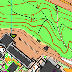
This map is like two venues in one: the hilly and wooded Shoreview Park and the complex campus of Shoreline Community College. Be prepared to switch mental gears as you move between the two!
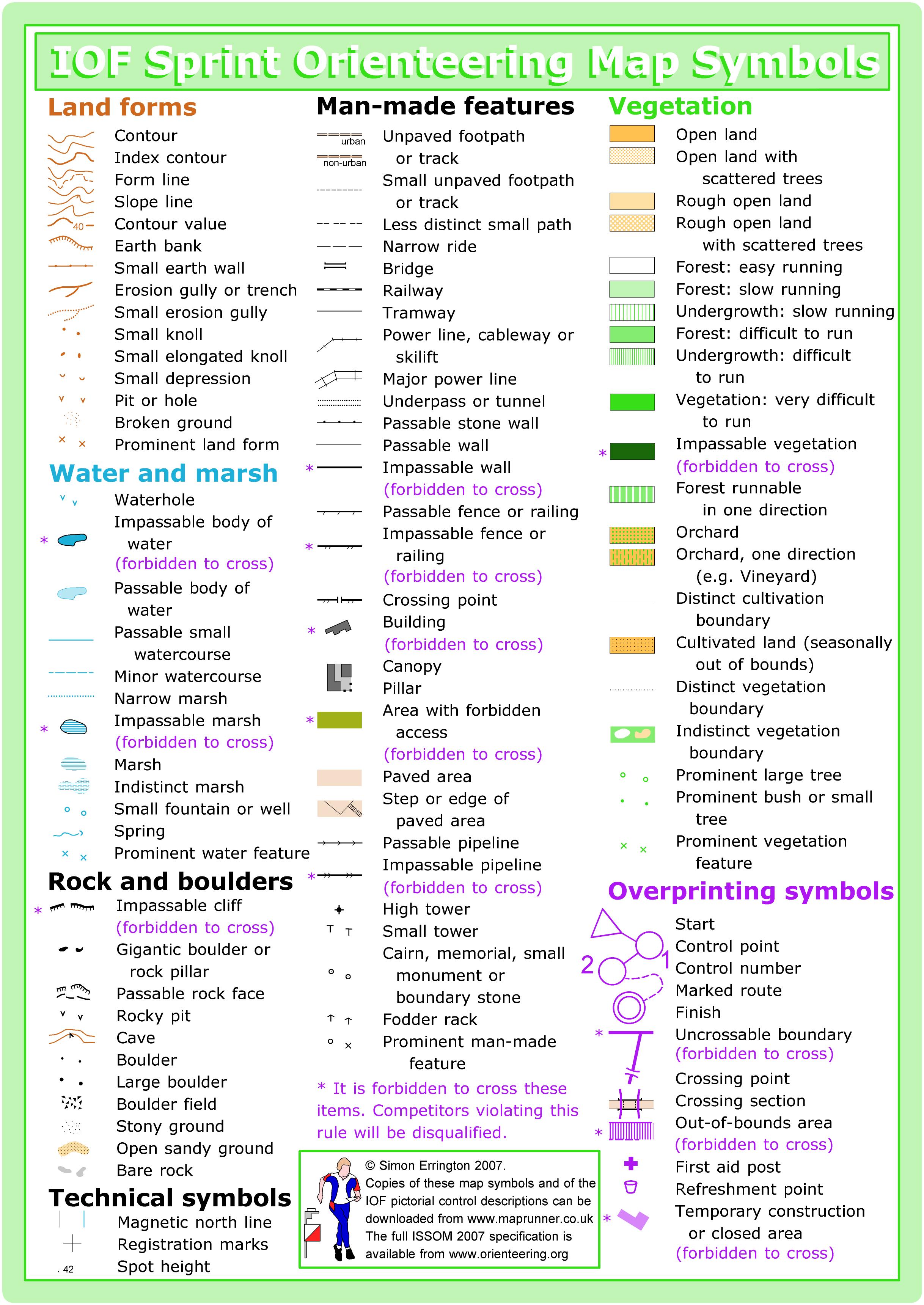
This venue is mapped to sprint standard (or ISSOM, the International Specification for Sprint Orienteering Maps). The sprint standard has a few key differences from traditional orienteering maps (or ISOM, the International Specification for Orienteering Maps):
- Some features (usually walls) can be marked as uncrossable (illegal to cross)
- Out-of-bounds is represented by olive green, which is used often for flower beds or private areas
- Footpaths and paved areas appear tan
- There are additional urban symbols, including canopies, which illustrate covered passageways
Read more on the map page
SAFETY & ETIQUETTE
Return to the Finish
All participants MUST return to the finish and download their e-punch or turn in their punch card.
Even if you have not finished your course, you must still return to the the finish and confirm with event staff that you have returned safely.
Out of Bounds
Some areas may be marked out of bounds. It is imperative to respect these boundaries to maintain our relationships with land managers. Participants MUST NOT go out of bounds. Any participant caught going out of bounds will be disqualified.
Course Closure
All participants MUST return to the finish by course closure time. If a participant does not return by course closure, event volunteers will begin coordinating a search party.
If you need a long time on the course, start as early in the start window as possible, wear a watch, and be prepared to cut your course short to make it back by the course closure time.
Whistle
All participants MUST carry a whistle on the course. Complimentary whistles are available at the start tent (please only take one).
If you are injured on the course and need assistance, blow three long blasts to call for help.
If you hear a call for help, abandon your course to find the person in distress.
Voices
Part of the fun and fairness of orienteering is navigating your own course, so please be polite when you find a checkpoint and don’t holler that you’ve found it.


