Winter League #5
WINTER LEAGUE
Saturday, January 12 at Fort Steilacoom – main entrance in Lakewood, WA
Meet Director: Jud Kelley
Winter League is the Pacific Northwest’s premier competitive orienteering series for all ages. Elementary, Middle School, and High School students compete under the banner of the Washington Interscholastic Orienteering League (WIOL). Cascade Orienteering Club also offers a competitive league for college students and adults, as well as non-competitive beginner-friendly categories at every event!
COURSES
Course designer(s): Jud Kelley and Jessica Colleran
| Course | Controls | Length | Climb |
| Beginner/Elementary | 8 | 2.0 km | 5 m |
| Middle School | 9 | 2.7 km | 45 m |
| Intermediate / JV Girls | 7 | 2.9 km | 40 m |
| JV Boys North | 8 | 2.7 km | 50 m |
| JV Boys South | 8 | 2.8 km | 45 m |
| Varsity | 11 | 4.0 km | 85 m |
| Short Advanced | 8 | 3.5 km | 75 m |
| Long Advanced | 14 | 6 km | 130 m |
How are courses measured?
Courses are measured as the crow flies, in a direct line from control to control. Unless you have wings, you will travel farther than this distance! Courses are measured in kilometers, so a good rule of thumb is to simply round up to miles to estimate how far you will go. So in a 5 kilometer race, you’ll likely travel up to 5 miles.
COURSE NOTES
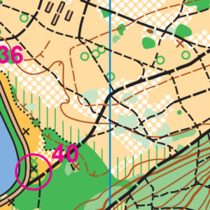
You will experience a wide variety of orienteering at Fort Steilacoom, with flat grassy areas, thick forest with a dense trail network, and urban campus all present. You will need to be able to adapt to all these styles! As usual, in the campus area do not cross through any of the plantings.
Some courses will cross the entrance road to the parking. Traffic is light but please look carefully before crossing. The Ft. Steilacoom Park map’s January 2019 update captures both changes within the park and some minor orienteering symbology changes. Ft. Steilacoom Park and the Pierce College campus are both heavily used by local residents and actively maintained by staff and volunteers.
The Ft. Steilacoom Park map’s January 2019 update captures both changes within the park and some minor orienteering symbology changes. Ft. Steilacoom Park and the Pierce College campus are both heavily used by local residents and actively maintained by staff and volunteers.
This year, like every year, there are new trails, old trails overrun by blackberries, new thickets of scots broom, and bramble patches returned to meadows by hard gardening work. The map updates tried to capture the current state of the trails, woods, and fields. Note that more areas of the park are mowed short than in the past. These areas are now mapped as open land (yellow) rather than rough open land (light yellow). Many of the trails, very obvious in the long grass of rough open land, are much more difficult to see or follow in short grass.
The updated map’s symbols are in line with the latest orienteering mapping standards (International Specification for Orienteering Maps, 2017). The legend printed on the map is updated and accurate. While most competitors won’t notice these changes, some of the point features changed for the benefit of color-blind orienteers (think brown-X (rootstock) or blue-O (fountain or well)). Since there is no longer a brown-X symbol, the green-X represents any prominent vegetation feature (large rootstocks or significant stumps). The large buildings on the Pierce College campus are now mapped in dark grey with a black border (like on sprint orienteering maps) rather than as solid black rectangles.
As before, the large dog park and the care-taker’s cottage and maintenance shed in the middle of the map are marked with the over-print “Out-of-bounds” symbol (purple cross-hatch). There is also some new landscaping southeast of the campus that is off limits for this meet.
For advanced course runners: In the SE corner of the map (wooded hillside), there is still a tangled area of deadfall from a long-ago ice storm. This area is mapped as dark green, with the numerous trails in the area mapped. In this dark green patch, there are trails that end at either side of a series of large, fallen trees. It is possible to pick your way slowly through this deadfall. Since the rootstocks and deadfall are too closely spaced to individually map, this area is shown as a patch of undergrowth/walk (thinly spaced green stripes or “slash”). You can run down the trail through the green, pick your way through this patch of deadfall (certainly not at a run), and then pick up the trail on the other side at a run. So, it’s passable, but not quickly. Showing no trails in the area would be incorrect, and showing trails going all the way through would also be incorrect, so until a trail crew with a chainsaw solves the underlying problem, this is the mapping compromise that attempts to do justice to the area.
SCHEDULE
9:30am – Registration opens & Newcomer instruction available
10:00am – Start opens
11:00am – Newcomer instruction ends
11:30am – Registration closes
Noon – Start closes
3:00pm – Course closes
Why is there a start window?
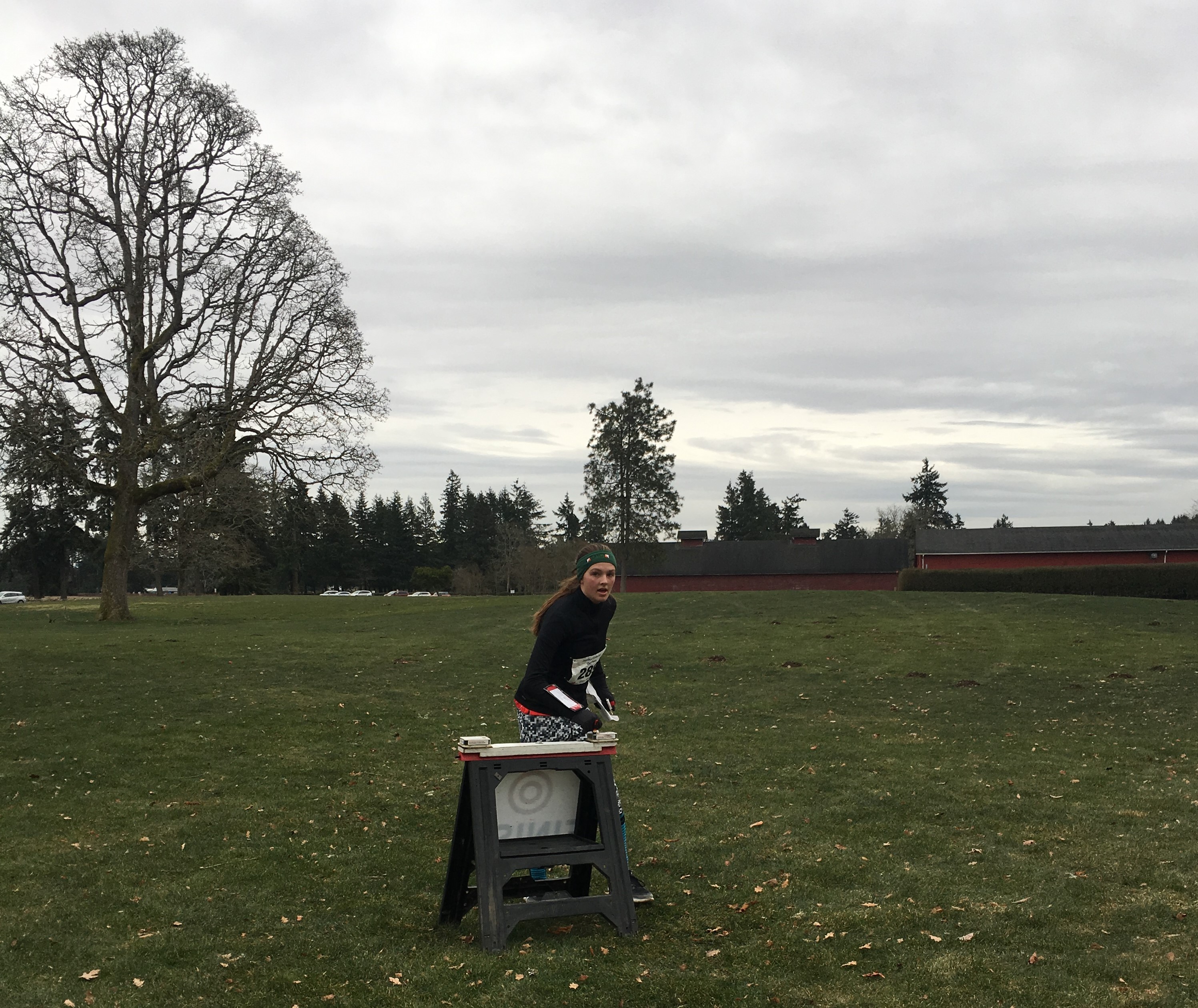
This event uses an interval start, which means that participants are started in waves instead of all at once. When you arrive at the start tent, find the chute for your course and follow the start volunteer’s instructions.
PRICES
Elementary, Middle School, Junior Varsity, and Varsity Students
Pre-Registration: $45 for all 8 events
Day of Event: $10 (cash or check only)
WIOL Admin Fee (once per season): $5 before October 13, $15 after.
Subtract $10 from the season pass if you own your own e-punch.
Intercollegiate Students, Adults, and non-competitive courses
Pre-registration: $17 (until Thursday 9pm)
Day of event: $20 (cash or check only)
Subtract $5 for Cascade OC members
Subtract $5 for using your own epunch
Get one event free if you pre-register for the entire season.
Become a Cascade OC member for $5-20
What’s an e-punch?
Orienteering uses RFID-like technology known as e-punch to record your race. At the start, finish, and each control, you’ll dip the e-punch into an electronic box, which will beep and flash as confirmation.
At the finish tent, download your e-punch to get your results (and let us know you’ve returned safely), then compare your splits and discuss your routes with other finishers!
You can rent an e-punch from Cascade OC , or buy your own from Wildwood Adventure Outfitters.
SIGN UP
Students with a season pass, use the button above to RSVP for this meet by Tuesday January 8 at Noon.
LOCATION
PARKING
Parking is free and plentiful. Follow the signs to the large parking lot near start.
CARPOOL
Looking for a carpool? Join the Yahoo listserv and share your request to find a ride.
THE MAP
While Fort Steilacoom is not rugged or remote, it can be fairly challenging for a city park. There are many criss-crossing trails here, both in open grass and in forest. However, there are also many distinct features such as buildings, roads, ballfields, and a small lake, that are great navigational aids.
Part of the park is very flat, while part of the park is quite steep. How steep your course is depends on which course you choose and how nice the course designer decided to be.
Read more on the map pageWarm up with a Micro O’ course!
As a training exercise or a short physical and mental warm up, two short Micro O’ will be set up near Registration. This will be a self-service activity and you will need to print your own maps [2019-01-12-Ft-Steilacoom-Micro] and description sheets [Micro-O-descriptions]. There is also a brief write up on how to use Micro O’ to practice “flow” [Micro-O-How-To 20180214]. The courses were not field checked so there might be minor discrepancies. Be very careful around moving people and vehicles! If you have questions (or suggestions), please see Mike Schuh – he’ll be working the first shift of Beginner Instruction somewhere near Registration.
***Please do not go through the children’s play area.*** It is marked on the maps as prohibited.
SAFETY & ETIQUETTE
Return to the Finish
All participants MUST return to the finish and download their e-punch or turn in their punch card.
Even if you have not finished your course, you must still return to the the finish and confirm with event staff that you have returned safely.
Out of Bounds
Some areas may be marked out of bounds. It is imperative to respect these boundaries to maintain our relationships with land managers. Participants MUST NOT go out of bounds. Any participant caught going out of bounds will be disqualified.
Course Closure
All participants MUST return to the finish by course closure time. If a participant does not return by course closure, event volunteers will begin coordinating a search party.
If you need a long time on the course, start as early in the start window as possible, wear a watch, and be prepared to cut your course short to make it back by the course closure time.
Whistle
All participants MUST carry a whistle on the course. Complimentary whistles are available at the start tent (please only take one).
If you are injured on the course and need assistance, blow three long blasts to call for help.
If you hear a call for help, abandon your course to find the person in distress.
Voices
Part of the fun and fairness of orienteering is navigating your own course, so please be polite when you find a checkpoint and don’t holler that you’ve found it.


