Winter League Championships – Point Defiance Park
**SPECIAL NOTICE** This is a National Ranking Event. In order to receive ranking points, you must run on a course that has an age category you qualify for. That means you may want to sign up for a different course than you normally do.
Please check this document to help you figure out the course and age class to sign up for. Once you know the course and qualifying age class you want, go to the registration page, select your course from the dropdown list, and then enter your age class, as well as your year of birth, in the appropriate field.
Although everyone running in a qualifying class will receive ranking points, only OUSA members are eligible for annual rankings.
Questions about age classes? Contact Debbie Newell
____________________________________________________________________________________________________________________________________
**AWARDS**
WIOL and Winter League awards will take place following the competition (approximately 2-3pm) at SAMI’s Environmental Learning Center located near the zoo entrance inside Pt Defiance Park.
_______________________________________________________________________________
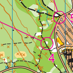
**SITE MAP** Please see site map here for all venue and awards location information.
COURSES
Course designer(s): Ing Uhlin and Dave Tallent
| Course | Controls | Length | Climb |
| 1 – Elementary/Beginner | 9 | 1.7 km | 40 m |
| 2 – Middle School | 9 | 2.6 km | 40 m |
| 3 – JV Rookie/Advanced Beginner | 9 | 3.1 km | 50 m |
| 4 – JV Girls/Intermediate | 10 | 3.1 km | 65 m |
| 5 – JV Boys | 12 | 3.1 km | 65 m |
| 6 – Varsity | 12 | 4.1 km | 80 m |
| 7 – Short Advanced | 14 | 4.6 km | 100 m |
| 8 – Intercollegiate/Long Advanced | 20 | 6.7 km | 130 m |
How are courses measured?
Courses are measured as the crow flies, in a direct line from control to control. Unless you have wings, you will travel farther than this distance! Courses are measured in kilometers, so a good rule of thumb is to simply round up to miles to estimate how far you will go. So in a 5 kilometer race, you’ll likely travel up to 5 miles.
COURSE NOTES
General information:
- The map had a major update last winter, especially of point features and trails. However, when we visited this winter, we noticed several new smaller trails of which many are not mapped.
- The map scale is 1:10,000 and the contours are 5 m.
- The vegetation has been updated. However, boundaries between dark and lighter green may not be totally accurate. Light green is walkable. The white areas are open and do offer enjoyable and fast routes. But the basic advice is, if it’s dark green, stay out.
- Many of the previously mapped knolls are in fact stumps.
- Stumps and root stocks have the same symbol in the control description.
- On the map, green X is a stump, brown X is a root stock, and green O is a distinct tree.
- Recent windstorms have created unmapped rootstocks.
- Courses routes
- There are several opportunities to choose an off-trail route.
- Legs were chosen to avoid unfriendly bush whacking.
- We encourage you to avoid roads and use parallel trail routes.
- We have designed the courses to emphasize a fun experience, but also to test your orienteering skills: compass; handrails and catching feature; attack points; pace counting; aiming off; using vegetation boundaries as handrails; and control extensions. Do you know your pace count for 100 m?
- Mandatory Crossing Points
- All courses except Long Advanced have one or two crossing points on the control description or course map – these crossing points are MANDATORY. Not using a mandatory crossing point may result in a DQ.
- Five Mile Drive (on the western part of the peninsula) will open to motor vehicles at 1 pm so you may encounter cars if you have a later start. But be diligent and observant when crossing any road at any time.
- This is a national ranking event recognized by OUSA. If you have not already reviewed the class/course table to make sure that you are registered for the correct course to give you ranking points for your age and gender, please take a moment to review the table and change your registration if needed.
Beginner/Elementary
Course 1 is a loop trail run. Apart from the manned pedestrian road crossing, there are no further road crossings. Safety was our first priority. The first leg is flagged and must be followed. Along the course there will be plenty of opportunity to observe point features located along the trails: stumps; rootstocks; and fire hydrants. Familiarize yourself with these symbols
Placements of controls are visible from the expected direction of travel, and the placement “pulls” participants onto the next handrail (trail). Control markers have been placed at every decision point (except the final two legs) and hence there is only one route-choice, one decision point. The final two legs, a route choice must be made. This will prepare participants for the next level, where route choice will be the norm.
Skills: direction of travel, handrails and catching feature (which will be another trail)
Middle School and JV-Rookie
These two courses are trail runs but with several route options for most legs.
Control placements are a few meters off the trail but visible from the trail and direction of travel. However, near the end of the course, the controls, although very close to the trails, will not be visible. Also, very short forest travel will be an option. This will prepare participants for the next level, where route choice, controls not visible, and off-trail will be the norm.
Skills: direction of travel, handrails and catching feature. Picking the safest route. Keen observation. The marker is often placed behind the feature. Read control description for control placement.
Intermediate/JV Girls
This course offers several opportunities to go off-trail. However, there are two legs when one will be on a road. Not fun. Some trails have fallen branches and downed trees.
Control placements are a few meters off the trail but not visible. Read your control description.
Skills: direction of travel, handrails, catching feature, pace counting (do you know how many steps it takes you to run 100 m?) and looking for definite attack points. Picking the safest route and keen observation are essential. The markers are often placed behind the feature. Read the control description for control placement.
JV Boys
This course offers multiple route choices and opportunities to run off-trail. One leg has eight micro routes! But which is the safest? Some trails have fallen branches and downed trees.
Control placements are a few meters off the trail but not visible. Read your control description.
Skills: direction of travel; handrails; catching feature; pace counting (do you know how many steps it takes you to run 100 m?) and looking for definite attack points. Picking the safest route and keen observation are essential. The marker is often placed behind the feature. Read the control description for control placement.
Varsity, Short Advanced and Long Advanced
These courses offer fast trail running, route choices, and opportunity to go off-trail, even for a short distance. Courses 6 and 8 are physical. Considering the audience for course 7, we have erred on the side of less physical and a tad easier. These courses have controls that are on the “outside” of the south side of the Five Mile Rd, but with route choices that avoid the cliffs. The Parks Dept. has fenced off dangerous trails and marked them as closed. Do not cross these boundaries in the unlikelihood that you find yourself in these locations.
Control placements are several meters off the trail but not visible. Read your control description.
Skills: direction of travel, handrails; catching feature; pace counting; looking for definite attack points; aiming off; control extension and picking the fastest but safest route.
A few words about Point Defiance Park: In addition to the old growth forest where most of our event will be held, Point Defiance offer many other attractions, please see https://www.metroparkstacoma.org/place/point-defiance-park/ and https://en.wikipedia.org/wiki/Point_Defiance_Park.
SCHEDULE
9:30 am – Registration opens
9:30 am – Newcomer instruction available
10:00 am – Start opens
11:45pm – Registration closes
Noon – Newcomer instruction ends
Noon – Start closes
2:30 pm – Course closes
**PLEASE NOTE COURSE CLOSURE IS NOW 2:30 PM FOR ALL WINTER LEAGUE MEETS**
Why is there a start window?
This event uses an interval start, which means that participants are started in waves instead of all at once. When you arrive at the start tent, find the chute for your course and follow the start volunteer’s instructions.
PRICES
PRE-REGISTRATION PRICES
$17 base price
– subtract $5 for CascadeOC members
– subtract $5 for using your own e-punch
DAY-OF-EVENT REGISTRATION
$20 base price
– subtract $5 for CascadeOC members
– subtract $5 for using your own e-punch
What’s an e-punch?
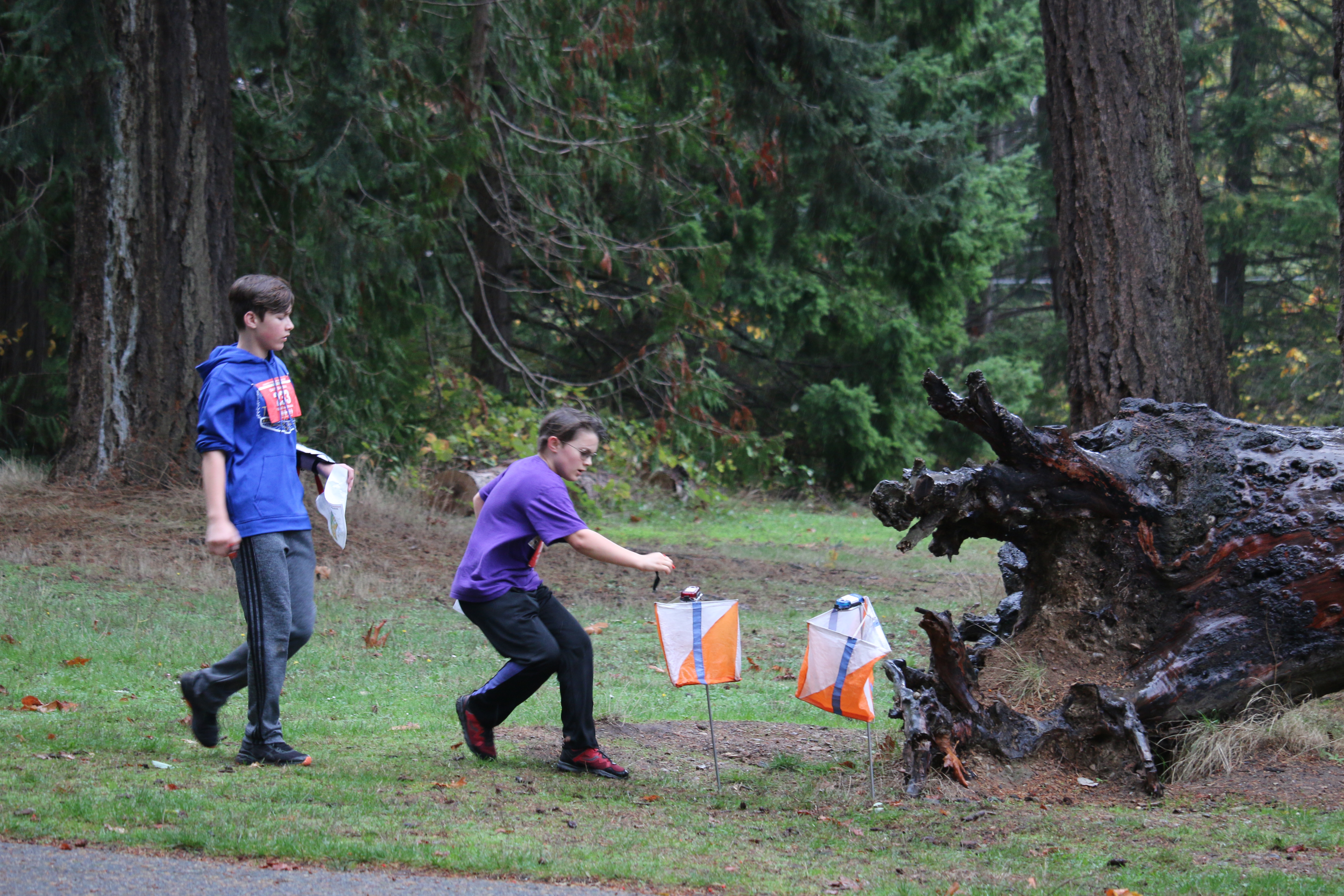
An e-punch records your race. At each control, you’ll dip the e-punch into an electronic box, which will beep and flash as confirmation. After you finish, you’ll download the e-punch at the download tent and get a receipt that show which controls you visited and how long you took between each; these are your “splits.”
Part of the fun of orienteering is comparing your splits with people who completed the same course, and discussing the routes you took!
SIGN UP
Online pre-registration closes:
Day-of-event registration is available by cash or check, made payable to Cascade Orienteering Club
LOCATION
PARKING
Parking is at Owens Beach within Pt Defiance. See site map here.
CARPOOL
Looking for a carpool? Join the Yahoo listserv and share your request to find a ride.
SAFETY & ETIQUETTE
Return to the Finish
All participants MUST return to the finish and download their e-punch or turn in their punch card.
Even if you have not finished your course, you must still return to the the finish and confirm with event staff that you have returned safely.
Out of Bounds
Some areas may be marked out of bounds. It is imperative to respect these boundaries to maintain our relationships with land managers. Participants MUST NOT go out of bounds. Any participant caught going out of bounds will be disqualified.
Course Closure
All participants MUST return to the finish by course closure time. If a participant does not return by course closure, event volunteers will begin coordinating a search party.
If you need a long time on the course, start as early in the start window as possible, wear a watch, and be prepared to cut your course short to make it back by the course closure time.
Whistle
All participants MUST carry a whistle on the course. Complimentary whistles are available at the start tent (please only take one).
If you are injured on the course and need assistance, blow three long blasts to call for help.
If you hear a call for help, abandon your course to find the person in distress.
Voices
Part of the fun and fairness of orienteering is navigating your own course, so please be polite when you find a checkpoint and don’t holler that you’ve found it.


