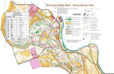
This Riverside State Park orienteering map was produced and is owned by our friends at Eastern Washington Orienteering Club.
Feeling a bit scuffed up from thick Western Washington forests? Take a trip to the east side to frolic through “white” open forest, and “yellow” open land. Camping and a gorgeous river are nearby, making it a real summer treat.
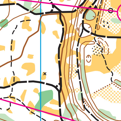
Note: Samples of the map are provided here for educational purposes only; the map shown here is not kept up-to-date. The course shown is a Beginner/Intermediate course, and actual controls do not exist in the terrain.
The purpose of providing these navigational and physical ratings below is to provide greater context for how challenging an orienteering course at this venue might be. For example, an advanced-level course at a local city park will be easier to complete than an advanced-level course in the mountains.