Many of our venues are built on hills. St Edward Park is the hilliest of them all! It is also among the first maps that this club created, more than 30 years ago.
This map combines two open and developed campuses with a complex trail network behind the college and another, simple set of trails going down the steep, steep slopes from the St. Edward historic seminary building to the water.
When used with adjacent land, this park provides enough geographic range that it has been used with a mountain bike orienteering course. Even without that section, it is routinely part of the large meets in the winter series and student league.
ABOUT THE PERMANENT COURSE
This venue features a permanent course, which you can do at any time! To try it out, print the PDF map and control descriptions below (or simply open them on your smart phone), read the instructions on the permanent course page, and have fun!
- Print/view the St. Edward State Park map
- Print/view St. Edward State Park control descriptions (needed to complete the permanent course)
- Introduction-Orienteering Permanent Course at St. Edward State Park
CascadeOC supports many permanent courses over a large geographic area and our volunteers have limited time to keep up with maintenance. If you observe any damaged, obscured, or missing markers, or if you can help regularly monitor and maintain this permanent course, please let us know. Thanks for your help!
To find more venues with permanent courses, visit the Map of Maps page, where each permanent course is marked by a yellow pin.
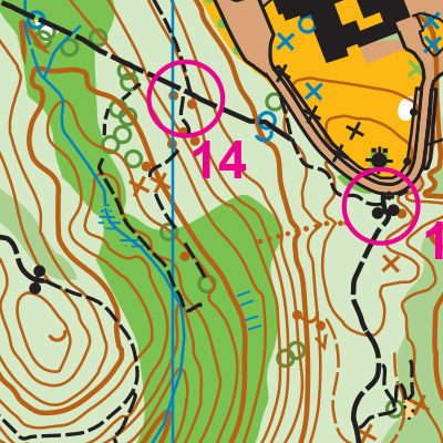
Note: Samples of the map are provided here for educational purposes only; the map shown here is not kept up-to-date.
The permanent orienteering courses at St. Edward State Park were designed and installed as a Boy Scout Eagle Award Service Project by Jeffrey Leonard, Boy Scout Troop 304, Lynnwood, WA.
The purpose of providing these navigational and physical ratings below is to provide greater context for how challenging an orienteering course at this venue might be. For example, an advanced-level course at a local city park will be easier to complete than an advanced-level course in the mountains.